In the realm of land ownership and property boundaries, precision is paramount. Accurate boundary line identification is a legal imperative that ensures landowners know their accurate property lines and helps prevent disputes with neighbors. Imagine walking into what you thought was your property, only to be met with a disgruntled neighbor claiming you’ve trespassed. That’s the kind of awkward situation many landowners find themselves in due to vague or incorrect boundary lines. With this blog post, we seek to untangle this knotty issue, empowering property owners everywhere with essential knowledge and tools for precise demarcation.
Understanding Boundary Lines
Ever played a game without knowing exactly where the out-of-bounds lines were? If so, then you understand how frustrating unclear perimeters can be – and this holds true for property lines too! For those tired of living in ambiguity or worried about becoming inadvertent trespassers on their own lands, our guide to accurate boundary line identification is set to bring clarity and confidence back into your life.

The Role of Land Surveyors
Land surveyors play an integral role in the process of finding the accurate property line. Their expertise lies in determining the exact location, dimensions, and limitations of a particular plot of land or property. A professional land surveyor is proficient in interpreting complex legal documents such as deeds and well-versed with local zoning laws and regulations. Thus, their input can be instrumental in settling any disputes related to boundary lines.
Preparing for a Boundary Line Survey
A meticulous approach is paramount in accurately determining property boundary lines. The process begins with an in-depth review of all relevant documents—the land’s legal description, past surveys, deeds, and any records connected to the property. Think of it as piecing together a complicated puzzle; no piece can be less important than the other, each holds vital information akin to the unique shape that forms part of the bigger picture. The surveyor dives deep into these documents: sifting through multiple layers of data to uncover hidden or overlooked details.
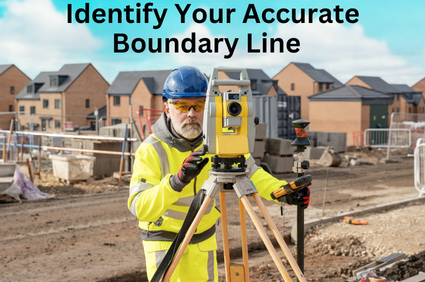
The next step involves conducting fieldwork where actual measurements are taken using sophisticated equipment like GPS systems, total stations, levels etc. These tools help in establishing coordinates for boundary lines and identifying any encroachments or overlapping claims on the property.
The Boundary Survey Process
A boundary survey typically involves several key steps:
1. Research and Document Review: Surveyors begin by meticulously examining property deeds, and historical records to gather information about the property’s boundaries.
2. Field Work and Data Collection: Surveyors head to the property, armed with advanced surveying equipment such as GPS devices and total stations. They collect data through precise measurements and the identification of physical markers.
3. Analysis and Calculation: Back at the office, surveyors analyze the collected data and perform calculations to determine the property’s exact boundary lines.
4. Boundary Marking and Monumentation: Finally, the surveyors mark the boundaries with physical markers or monuments, providing a clear and lasting indication of property lines.
This process, executed with precision, ensures the accurate identification of property boundaries.
Common Boundary Issues
Boundary disputes can arise due to encroachments, discrepancies, or ambiguities in property lines. Encroachments occur when one property owner inadvertently crosses into another’s territory. Discrepancies may arise from errors in past surveys, while ambiguities can result from vague property descriptions in deeds. To illustrate the real-world impact of boundary issues, consider the case of a neighbor’s fence mistakenly built several feet onto your land.
Resolving Boundary Disputes
Land surveyors play a vital role in resolving boundary disputes. Through negotiation, mediation, or, if necessary, expert testimony in court, they help property owners reach agreements and prevent costly legal battles. A boundary surveyor’s professional expertise can be invaluable in settling disputes and preserving neighborly relations.
Boundary Line Maintenance
Once your boundaries are established, maintaining them is crucial to prevent future disputes. Property owners should regularly inspect and maintain physical markers, fences, and other boundary indicators. A well-maintained property boundary not only avoids conflicts but also contributes to a well-organized and aesthetically pleasing property.
Conclusion
Accurate boundary line identification is the bedrock of property ownership and the key to peaceful coexistence with neighbors. By understanding the nuances of property boundaries, enlisting the expertise of land surveyors, and actively maintaining your boundaries, you can ensure a harmonious and legally secure property ownership experience. When in doubt, always consult a licensed land surveyor to navigate the intricacies of boundary identification. For further information on land surveying and boundary identification, visit the National Society of Professional Surveyors website.
